Reliable atmospheric data accessible to all.
Most historical weather data is a patchwork of gaps and errors. Your model is only as good as what goes in — so we obsessed over what goes in.
Severe Weather Forensics
Event analysis and attribution for hail, tornado, wind, and freezing rain.
Historical Archives
Terabytes of global 15km gridded history, with 1km / 2km hi-res across CONUS.
Station Intelligence
Records back to 1950 across 8,000+ global stations — normals, history, and trends.
Risk Assessment
0–10 risk scores for wildfire, flood, hail, wind, tornado, and rainfall — anywhere in CONUS.
Visual Intelligence
Interactive maps and severe-weather analysis, generated on demand.
Hurricane & Forecasting
Tropical cyclone tracking with AI-enhanced ensembles, plus 10-day global forecasts.
barocline contains a curated stack of public, partner, and internally-processed sources.
What makes this different from public alternatives is what you don’t have to build. Raw NOAA data is free — but turning it into validated answers takes infrastructure. Athenium has been doing that work for federal agencies, reinsurers, IBM, and others for decades. barocline is the first time it’s available to everyone.
- 1 credit5 days of hub-height wind at hourly resolution
- 1 creditA decade of monthly station history
- 1 creditFour months of daily reanalysis for any variable set
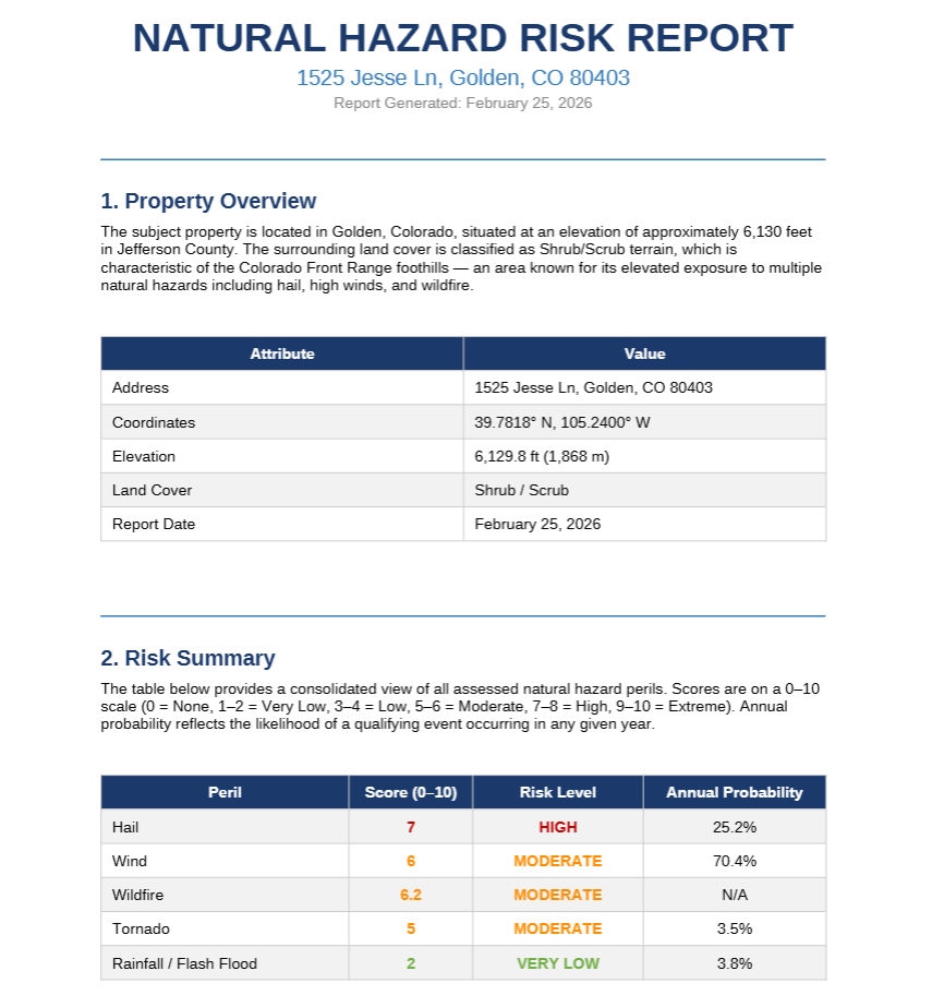
Natural Hazard Risk Assessments
Comprehensive natural hazard risk assessment reports for any U.S. location
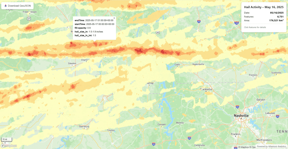
Peril Verification Maps
Verification map of hail, tornado, freezing rain, or other perils
Plan Your Day
What to wear, when to travel — use reliable forecast data to plan your day based off weather impacts
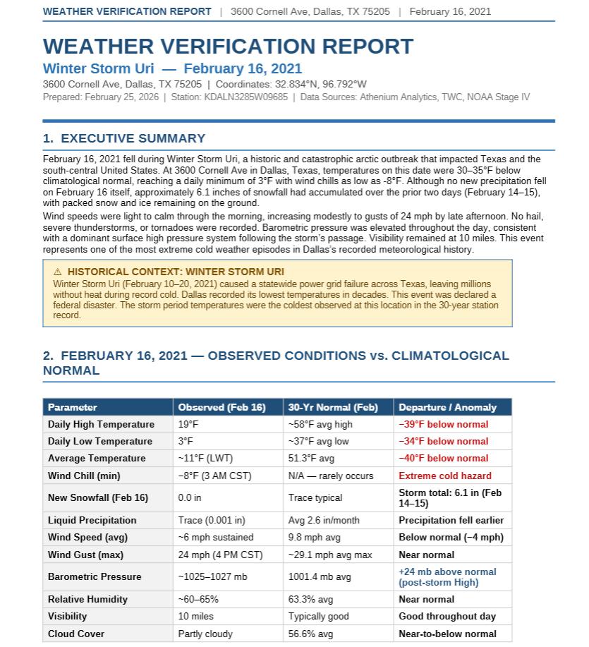
Weather Verification Report
Comprehensive weather verification reports for any event globally
Historical Data & Trends
Every location. Every hour. Every trend — global weather history back to 1950.

